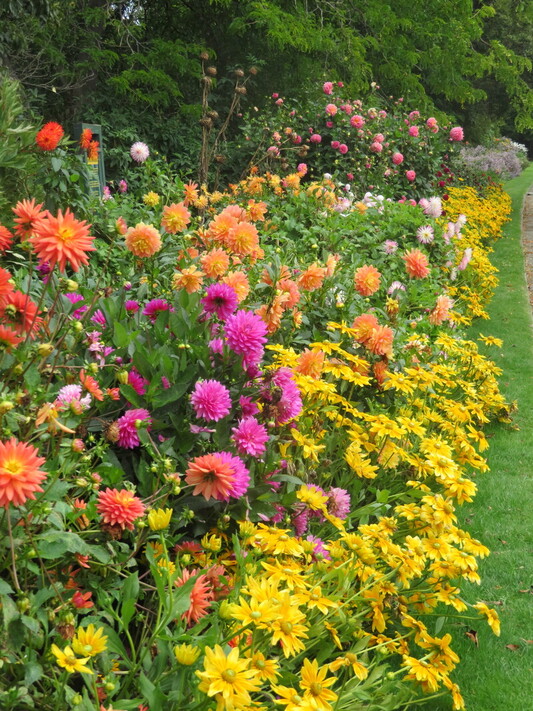
 When I visited the Timaru Botanic Gardens last year to take photos of the Robbie Burns statue I also took some of the colourful dahlia border that was still blooming profusely well into autumn. As we are settling in for the long lockdown ahead I thought it might be interesting to find out a little of the history about these beautiful and reliable garden performers. They are such a cheerful summer/autumn addition to a home garden, blousy, bold and available in an amazing variety of colours as well as being easy peasy as to grow. Dahlias originated in the mountain regions of Mexico and Guatemala and they still thrive there today. Before the time of the Aztecs not much is known about them but it is recorded that the Aztecs used parts of the dahlia for food and medicine.
In the 1570’s King Phillip ll of Spain sent a botanist, Francisco Hernandez, to Mexico to study the natural resources of the country and he described plants that resembled dahlias at that time. However it wasn’t until 1789 that plant parts were sent from the Botanical Garden at Mexico to the Royal gardens of Madrid in Spain. From there culture and propagation began and 3 new plant forms were grown. The genus was named after a Swedish botanist, Andreas Dahl. Seed and plant parts from the dahlias were sent throughout Europe from the early 1800’s and hybridization work continued. Double forms and colour variations resulted and captured the imagination and passion of plant breeders throughout Europe. Continued propagation and development of the earlier crosses resulted in the first modern dahlia hybrids being created around 1929. These new hybrids were easy to grown and hybridize so they quickly became very popular in European and American home gardens. Throughout the 1800s and 1900s thousands of new forms were developed and all of these new dahlia forms were hybridized from at least two, possibly all three of the original Dahlia species sent from Mexico in 1789. The dahlia we know today has one of the largest variations of form, colour and size of any flower grown and every year there are new varieties being developed and released constantly. It remains the National Flower of Mexico where its beauty, as well as usefulness, was first discovered by the Aztec Indians so long ago. We have our very own local dahlia specialists, Alistair and Joan Davey. Alistair was 13 years old when his great uncle gave him his first dahlia and that gift sparked a lifelong passion for these remarkable flowers. Have a look through his website, www.daveygardens.com and while away an hour or so plotting where you can perhaps squeeze one into your garden after this long winter ends. Keep well and safe, Karen Rolleston
0 Comments
 Some recent photos on Wuhootimaru’s Face Book page featuring an old cottage on the outskirts of Pleasant point piqued my interest and I decided it needed following up.
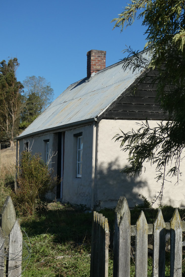
James and Ellen Keane were immigrants from County Kerry in Ireland. They arrived in New Zealand on the 1st July 1861 after travelling aboard the “Chrysolite” which departed Gravesend, London in April of the same year. After landing in Lyttleton the Keanes spent 10 years living in Christchurch before they and their 5 children headed to their new home in South Canterbury. This hard working couple managed to get together enough money to buy a piece of farmland and build a home for themselves and their family to live in. The house they built is the substantial cob cottage that still stands on its original site to this day. This one is two storeyed with a large ground floor living room and an upper room or loft where the family all slept. The covered wagon or schooner they travelled south in stood on their property near the cottage well into the 1940’s. Cob cottages were well built and a favourite with our early settlers. Utilising the local soil and clay for the raw materials as well as labour and skills given by other community settlers it meant they were relatively cheap to construct. A feature is their excellent thermal protection that makes them suitable for extremes of climate. In terms of longevity, cob buildings have the potential to remain functional, with regular maintenance, for hundreds of years. This one has been well tended by past and present landowners, sited along Keanes Rd just off the Point highway; it is fenced apart from the surrounding farmland and well protected from stock. The cob has been restored, the tin roof is in good order and it has spouting which all help keep Keane’s Cottage in the great state it remains in today. Cob buildings were once a significant part of New Zealand's early history and census figures from 1845 recorded more than 40 per cent of building stock in the South Island was of earth construction. As times progressed and more building materials became available this percentage declined to the point where there are fewer than 200 earth dwellings in the South Island today. Karen Rolleston |
|
|
|
